Travel Guide of Adelaide Hills in Australia by Influencers and Travelers
The Adelaide Hills region is located in the southern Mount Lofty Ranges east of the city of Adelaide in the state of South Australia. The largest town in the area, Mount Barker is one of Australia's fastest-growing towns. Before British colonisation of South Australia, the area was inhabited by the Peramangk people. The Adelaide Hills wine region comprises areas of the Adelaide Hills above 300 m.
Download the Travel Map of Australia on Google Maps here
Pictures and Stories of Adelaide Hills from Influencers
Picture from Nadir sYzYgY who have traveled to Adelaide Hills
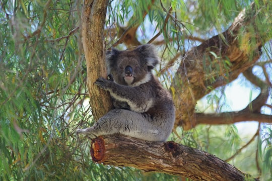
- Koala sitting relaxed in tree ...click to read more
- Experienced by @Nadir sYzYgY | ©Unsplash
Plan your trip in Adelaide Hills with AI 🤖 🗺
Roadtrips.ai is a AI powered trip planner that you can use to generate a customized trip itinerary for any destination in Australia in just one clickJust write your activities preferences, budget and number of days travelling and our artificial intelligence will do the rest for you
👉 Use the AI Trip Planner
The Best Things to Do and Visit around Adelaide Hills
Disover the best Instagram Spots around Adelaide Hills here
1 - Morialta Conservation Park
Morialta Conservation Park, formerly the Morialta Falls Reserve and the Morialta Falls National Pleasure Resort, is a protected area 10 km north-east of Adelaide city centre, in the state of South Australia, Australia.
Learn more Book this experience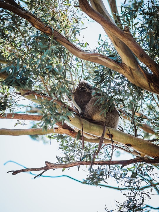

2 - Mount Lofty
6 km away
Mount Lofty is the highest point in the southern Mount Lofty Ranges. It is located about 15 km east of the Adelaide city centre in South Australia, and has panoramic views of the city and the Adelaide plains to the west, and of the Picadilly Valley to the east.
Learn more Book this experience

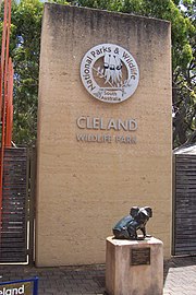
3 - Cleland Conservation Park
6 km away
Cleland Conservation Park is a protected area located in the Adelaide Hills, South Australia about 22 kilometres south-east of the Adelaide city centre.
Learn more Book this experience
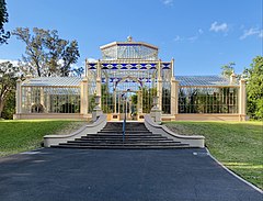
4 - Adelaide Botanic Garden
9 km away
The Adelaide Botanic Garden is a 51-hectare public garden at the north-east corner of the Adelaide city centre, in the Adelaide Park Lands. It encompasses a fenced garden on North Terrace and behind it the Botanic Park. Work was begun on the site in 1855, with its official opening to the public on 4 October 1857.
Learn more Book this experience
5 - Adelaide Zoo
9 km away
Adelaide Zoo is Australia's second oldest zoo, and it is operated on a non-profit basis. It is located in the parklands just north of the city centre of Adelaide, South Australia.
Learn more Book this experience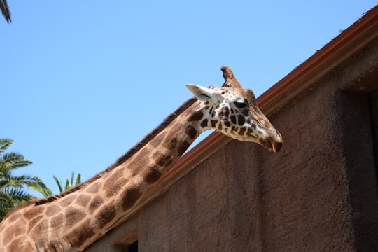
6 - Botanic Park
9 km away
Botanic Park, part of Park 11, is a 34 hectare park in the Northeast Parklands of the South Australian capital of Adelaide. The park is bordered by Hackney Road and Frome Road.
View on Google Maps Book this experience
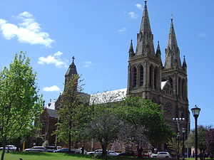
7 - St Peter's Cathedral
10 km away
St Peter's Cathedral is an Anglican cathedral in the South Australian capital of Adelaide. It is the seat of the Archbishop of Adelaide and Metropolitan of the Province of South Australia.
Learn more Book this experience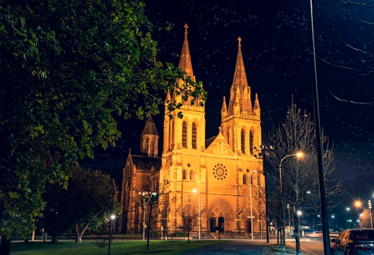
8 - Adelaide Central Market
10 km away
The Adelaide Central Market is one of the largest undercover fresh produce markets in the Southern Hemisphere, with 1 million kilograms of fresh produce delivered to the Market and sold every month.
View on Google Maps Book this experience
9 - Adelaide Town Hall
10 km away
Adelaide Town Hall is a landmark building on King William Street in Adelaide, South Australia, Australia. The City of Adelaide Town Hall complex includes the Town Hall and the office building at 25 Pirie Street.
View on Google Maps Book this experience
10 - Adelaide Oval
10 km away
Adelaide Oval is a sports ground in Adelaide, South Australia, located in the parklands between the city centre and North Adelaide.
View on Google Maps Book this experience
11 - Pioneer Women's Memorial Garden
10 km away
The Pioneer Women's Memorial Garden in Park 12 of the Park Lands of Adelaide, South Australia, is a tribute to the pioneer women of South Australia.
View on Google Maps Book this experience12 - Bonython Park
12 km away
Bonython Park is a 17-hectare park in the north-west Park Lands of the South Australian capital of Adelaide. The park was opened in 1962 and named in honour of prominent South Australian politician and journalist, Sir John Langdon Bonython.
View on Google Maps Book this experience
13 - Stirling
17 km away
Stirling is a town in the Adelaide Hills, South Australia, approximately 15 km from the Adelaide city centre. It is administered by the Adelaide Hills Council. Neighbouring townships are Crafers and Aldgate. Other nearby towns are Heathfield and Bridgewater.
Learn more

14 - Harbour Town
18 km away
Harbour Town is a shopping centre concept that incorporates multiple factory outlets in one centre. As of February 2021, there are two locations owned and operated under the Harbour Town brand: Biggera Waters, on Queensland's Gold Coast, and at Adelaide Airport, in South Australia.
View on Google Maps Book this experience
15 - South Australian Maritime Museum
20 km away
The South Australian Maritime Museum is a state government museum, part of the History Trust of South Australia. The Museum opened in 1986 in a collection of historic buildings in the heart of Port Adelaide, South Australia's first heritage precinct.
View on Google Maps Book this experience
16 - Torrens Island
21 km away
Torrens Island is an island in the Australian state of South Australia located in the Adelaide metropolitan area in the Port River Estuary about 15 kilometres northwest of the Adelaide city centre.
View on Google Maps Book this experience
17 - Rundle Street
21 km away
Rundle Street, often referred to as "Rundle Street East" as distinct from Rundle Mall, is a street in the East End of the city centre of Adelaide, the capital of South Australia.
Learn more
18 - Adelaide
22 km away
Adelaide is the capital city of the state of South Australia, and the fifth-most populous city of Australia. The demonym Adelaidean is used to denote the city and the residents of Adelaide.
Learn more
19 - Adelaide SA
22 km away
Adelaide AD-ə-layd, is the capital city of the state of South Australia, and the fifth-most populous city of Australia. The demonym Adelaidean is used to denote the city and the residents of Adelaide.
Learn more
20 - Belair National Park
22 km away
Coffin Bay National Park is a protected area in on the Eyre Peninsula of South Australia, Australia, which is located about 301 km west of Adelaide and about 46 km west of Port Lincoln. The town of Coffin Bay is near the entrance to the national park.
Learn more Book this experience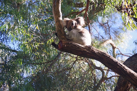
Book Tours and Activities in Adelaide Hills
Discover the best tours and activities around Adelaide Hills, Australia and book your travel experience today with our booking partners
Where to Stay near Adelaide Hills
Discover the best hotels around Adelaide Hills, Australia and book your stay today with our booking partner booking.com
More Travel spots to explore around Adelaide Hills
Click on the pictures to learn more about the places and to get directions
Discover more travel spots to explore around Adelaide Hills
🌲 Nature reserve spotsTravel map of Adelaide Hills
Explore popular touristic places around Adelaide Hills
Download On Google Maps 🗺️📲